
I make most of my maps for publications and presentations in QGIS using the Print Layout feature. This is a wonderfully detailed tutorial if you want to learn more about print layouts. Right now I’m using the print layout to make maps of pH, organic matter, and soil test potassium to include in an update for the farmers collaborating on this trial. The maps themselves are blocked out for their privacy.
In past versions of QGIS, you could change paper size and orientation under the layout tab on the right-hand menu. Usually I would do this at the beginning of the figure-making process so that I know if my map meets the size restrictions for whichever publication I’m planning on submitting to.
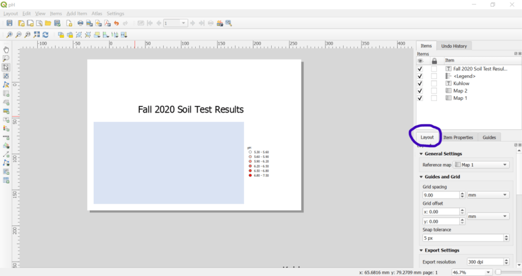
This feature is very different in QGIS 3, but I really like it because it helps keep the margins around that content to be small so that my image file sizes aren’t larger than necessary.
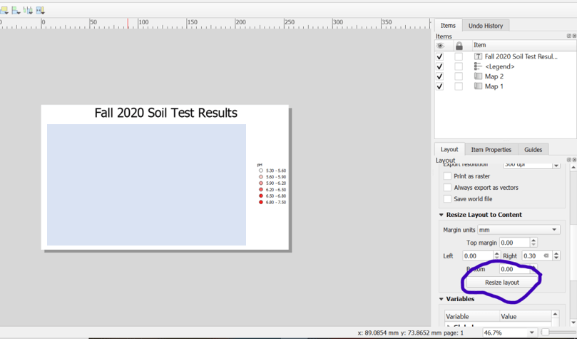
You just lay out your map components on the default page size and then trim the virtual paper to fit using the “resize layout” button. If you don’t have enough space on the default page size, you can put items in the grey space around the page. Then the “resize layout” button will expand the virtual paper to fit everything.
It’s a small feature, but I’ve found it really helpful this month and wanted to share. Happy New Year!
