
I broke out SAGA again this week to do some soil interpolations. I don’t usually use inverse distance weighting (IDW) for much because you can’t generate error maps or use covariates with this method. For this project I needed to make some maps in IDW to compare back to other methods. I’m using IDW for that comparison because it’s commonly used for soil interpolation performed in ag softwares such as SMS. If you’re not an SMS user but need an IDW map for any reason, I’d recommend using SAGA because it’s free and implements IDW pretty easily.
Haven’t used SAGA before? I’d recommend starting with my previous Intro to SAGA post– it covers some SAGA basics and shows you how to import raster data.
I don’t have good example point data for this, so this post is lacking good pictures. IDW is pretty simple to implement though, so you should be able to follow along regardless. The first step is to import your point data using the directions in the Intro to SAGA post (Geoprocessing->File->Shapes->Import).
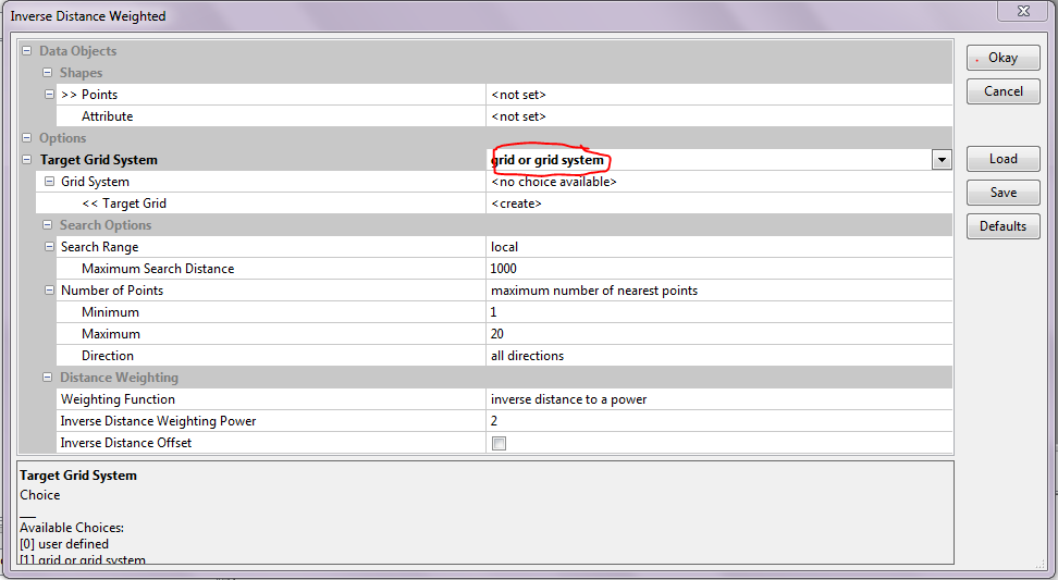
Once your data is imported, you’re ready to implement IDW! To open the IDW pop-up window, go to Geoprocessing->Grid->Gridding->Interpolation from Points->Inverse Distance Weighted. See the pop-up window example below.
To execute IDW, the first step is to select your points system (the shapefile you imported) and the attribute within that shapefile that you want to interpolate. Remember that you can only interpolate continuous (numeric) variables.
IDW does not use covariates in its interpolation– it’s just a spatial weighted average of the values at nearby points. Since you don’t specify grid covariates, you need to specify the grid extent for the interpolation. You can use that by telling SAGA to match to another grid you load in the line circled in red on the menu image, or alternatively can give it resolution and dimension info to build a new grid.
The search range determines how many cells away the algorithm will look for a point to include in its calculation for a given cell. The maximum and minimum number of points determine how many points from your shapefile are used to calculate the value in a given cell. SAGA suggests defaults based on the number of points in your shapefile and the size of your output raster.
The weighting function (almost always inverse distance to a power) and power determine how much weight is given to each nearby point when calculating the value for a cell. Higher powers will produce smoother looking maps.
Set your functions, powers, and search features, and hit “Okay.” That’s really it! When you’re all done, you can export a GeoTIFF of your interpolated surface using instructions in this previous post, or view your map in SAGA itself.
