I’m taking a quick break for data collection tools to share a feature of Google Maps I use all the time– bike routes! I love my bikes almost as much as I love my dogs….
I bike for transportation more days than not and am pretty familiar with the trails and bike-friendly roads in my area. But when I’m traveling, I prefer to look up safe routes before hopping on my bike. Paper maps are a great way to find trails, but I never have them with me when I need them and they don’t always reflect new bike lanes or current construction. Usually my phone is handy though, and Google Maps has bike routes marked– you just have to turn on the bicycling map once, and it’ll populate every time you open the app!
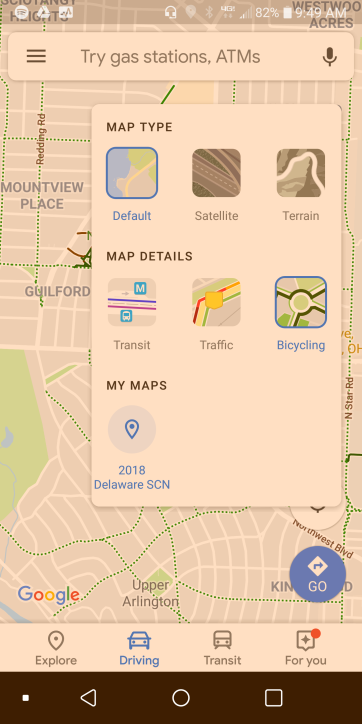
Here’s how simple it is– open Google Maps on your mobile device and click the “map types” button on the right side (the round button with the square symbol just above the compass). 
When you open the map types menu, select “Bicycling” and that will turn on the green dotted lines for bike routes!

Is it a complete map? Nope. But it’s a lot better than nothing, and it’s usually pretty good. You can also get turn by turn navigation in Google Maps for cycling by changing the transportation method from driving or walking to cycling (look just below the destination option). This will also give you a quick summary o the elevation changes on the proposed route.
Go out and enjoy the break in the heat!

[…] on this blog, other than the home page, is the About Me page. Second most popular is the FAQ page. Bike Routes and Selecting a Projection for Spatial Analysis are tied for most popular blog […]
LikeLike