
Last week I posted about on-the-fly projections, which is enabled by default in QGIS. It works so well that sometimes we forget when layers are in different coordinate reference systems until we try to run a geoprocessing algorithm. Fortunately, when you inevitably run into this issue it is very easy to solve.
To illustrate this process, I pulled out the example QGIS project from my last post. It includes a polygon file of the drainage basins of the Great Lakes (EPSG:4269) and an incredibly arbitrary point file (EPSG: 4326). If you need a refresher on EPSG numbers and coordinate reference systems, go here. You’ll notice these two vector files are in different coordinate reference systems. If I were to try to generate the intersection of these files, I would get an error message. Before I try any geoprocessing algorithms, I’m going to save a copy of the point file in the CRS from the polygon file so that they match (EPSG: 4269).
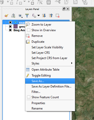
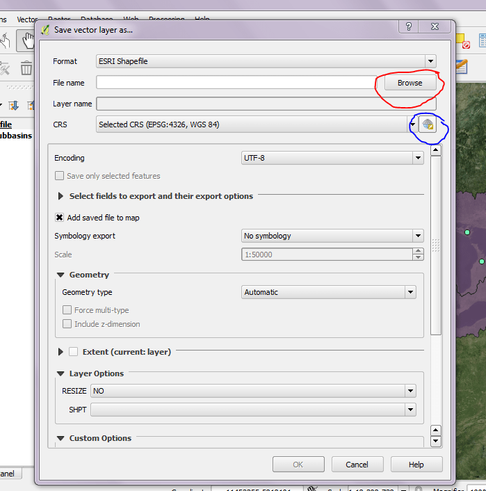
To copy and save the point file, start by right-clicking on the file name in your layer panel (see screenshot to left). That will open a pop-up window (see screenshot below). First thing to do in this pop up is to decide where the new file will be saved by using the browse button (circled in red). Next you should click the little globe with a hat (circled in blue) to get to select your CRS.
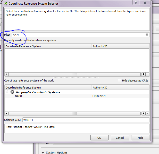
When you click the CRS button you’ll get another pop-up. Use the filter button (circled in blue) to search using the EPSG number (4269 for today). Then you can click your correct CRS and hit Okay.
Once you’ve decided where your file is going and selected the right CRS, you’re good to hit okay and save it. I recommend keeping the EPSG number in the new file name just to help you keep track of everything. Now you should be good to run whatever geoprocessing algorithms you need between the drainage basins and the new point file.

[…] out the collaboration and track changes features! You can reproject during geoprocessing, making my previous troubleshooting post […]
LikeLike