
For a long while the most frequent question I got from other GIS users was, “hey, can I have a copy of your county map shapefile?” This really easy to get from the Ohio Transportation Mapping System website, but somehow I still end up emailing out this file at least every couple months. Today I’m going to show you the TIMS website, the Wisconsin State Cartographer’s website, and the National Weather Service portal.
First up, TIMS! I find the new TIMS portal very easy to use, but I’ll walk you through downloading a county map just in case you don’t find it intuitive. Once you get to the TIMS data download home page, use the drop down menu for the “Boundaries” files to see the “county” option. When you click “county” it will turn green, and the number in the blue “Export data” box will increase by 1.
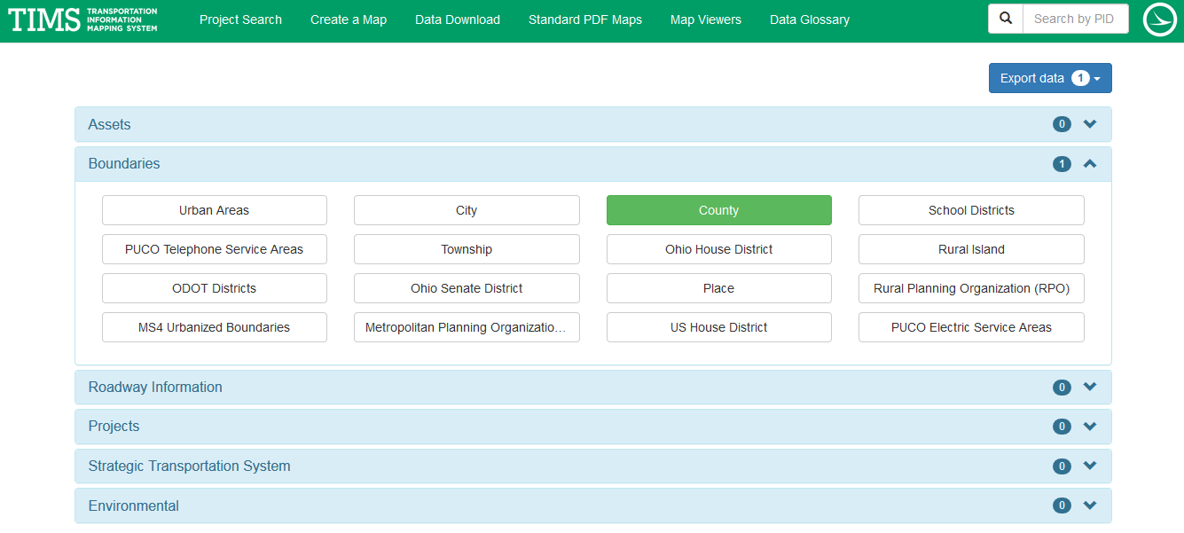
Once you’ve selected all the data you need today, click the “Export data” to start downloading a zip file with all your selections. It’s that easy! If you’re opening shapefiles from TIMS, they should come with projection information in a .prj file. If it doesn’t, there’s usually a text file with metadata to give you projection information.
If you’re looking for Wisconsin data, there’s also a very easy to use portal. The State Cartographer’s Office keeps links all sorts of data, including imagery, elevation, boundaries, and roads. Most links direct you to the GeoData@Wisconsin portal, which has both text and geographic search functions.

My favorite thing about the GeoData portal is that it has the year right next to the download button, which saves a ton of time sifting through metadata.
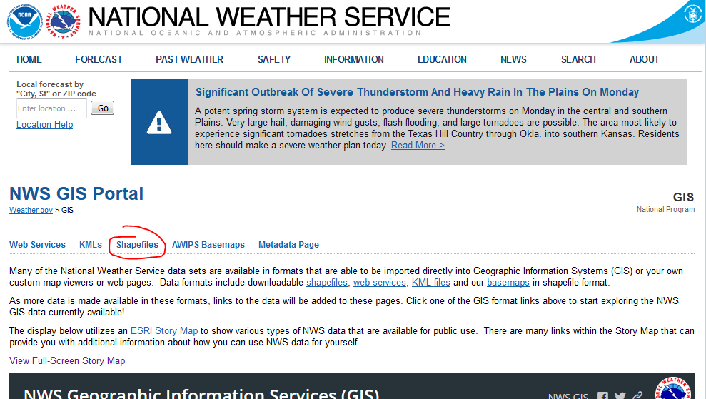
When I need data that spans multiple states, I usually use the National Weather Service GIS site. If you click the Shapefiles menu button, this will give you tons of weather data download options. If you’re looking for a state map, etc., even if you want it as a shapefile, don’t click that button! Go to the “basemaps” link in the paragraph below the menu. Other than that, it’s a very similar portal to TIMS and GeoData@Wisconsin.

This is the last of my data downloads series for now, but I’m always open to suggestions for future posts!
